
All Internet servers together draw the world map, but global interconnection is also represented in many other maps that collect data from different activities and sectors.
It is especially interesting to observe the size and magnitude of the Internet through maps like the submarine cables’ map, which shows the submarine cables which carry most of the Internet’s global traffic, or the map which shows the most used mobile phones over different places in the world, based on 280 million tweets posted from mobile phones.
Internet servers in the world
Even though this worldwide servers’ map is not on scale, it gives an idea of how servers and cloud computing platforms are distributed over the planet. North America, Europe and Japan are perfectly defined; followed by the Asian zone, Australia and Latin America. However, Africa — which is more in the rear in data center deployment — can be guessed, but it is not clearly defined.
This impressive world map is made of dots that symbolize the most representative data centers with Internet servers of the world. According to the latest studies, in 2017 there were more than 8.5 million data centers in the world. However, it is difficult to know the exact number due to the great variety of these centers and its continued growth.
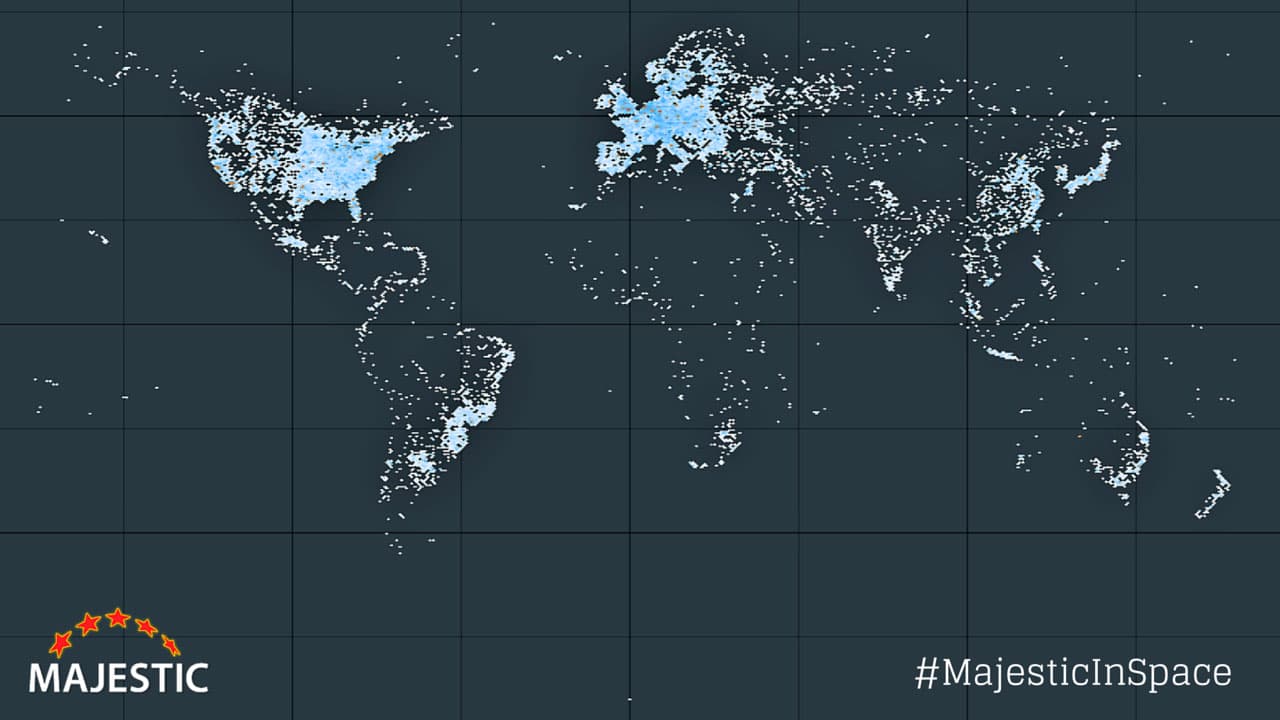
Thanks to Majestic we can observe the servers’ map created with data from thousands of servers, which are part of geolocalized public data. When in doubt, dots are automatically represented in the center of the countries or in their capitals.
Submarine cables’ map
This submarine cables’ map creates a similar effect, since there are currently more than 400 submarine cables all around the world. Fiber optic submarine cables go across thousands of kilometers to connect different regions and countries, providing high-speed Internet access. For instance, the SeaMeWe-3 is about 39.000 km long, connecting a long list of countries from Asia, Oceania, Africa and Europe.
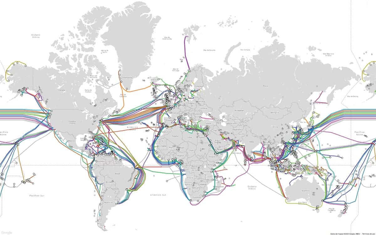
See the interactive map of the submarine cables connecting the Internet.
This effect also occurs on maps with the night lights of the most populated cities, roads, maritime routes and airways. This way of drawing the outlines of the planet’s continents thanks to big data is very interesting. Here are some versions of the world’s map.
Other world maps based on big data
The most used mobile phones world map
This map, based on 280 million tweets posted from mobile phones, shows the most used mobile phones over different places in the world.
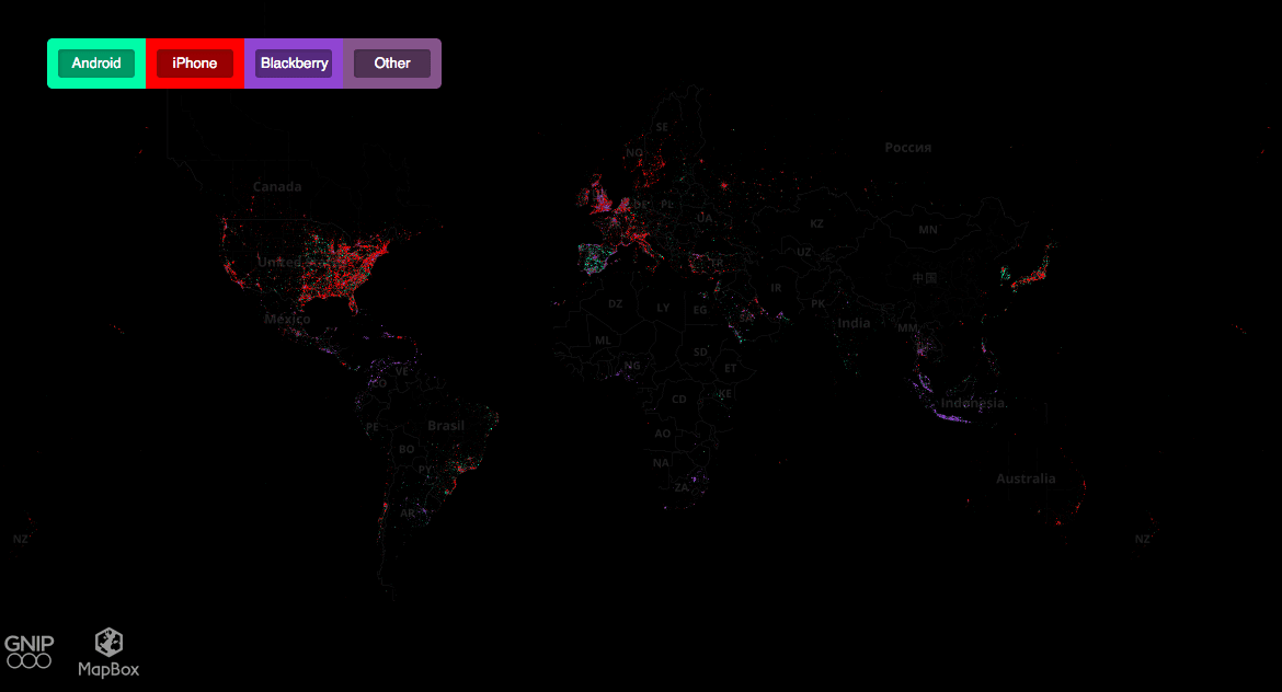
See the interactive map of the most used mobile phones in the world.
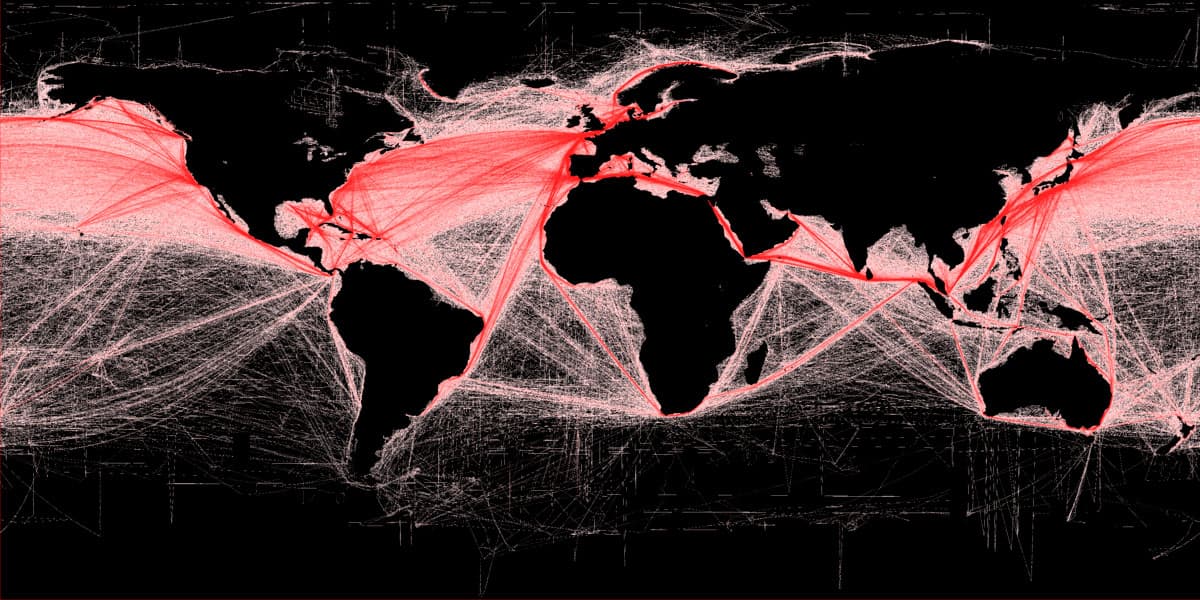
The world’s maritime routes map
This map shows the most commonly used maritime routes in the world.
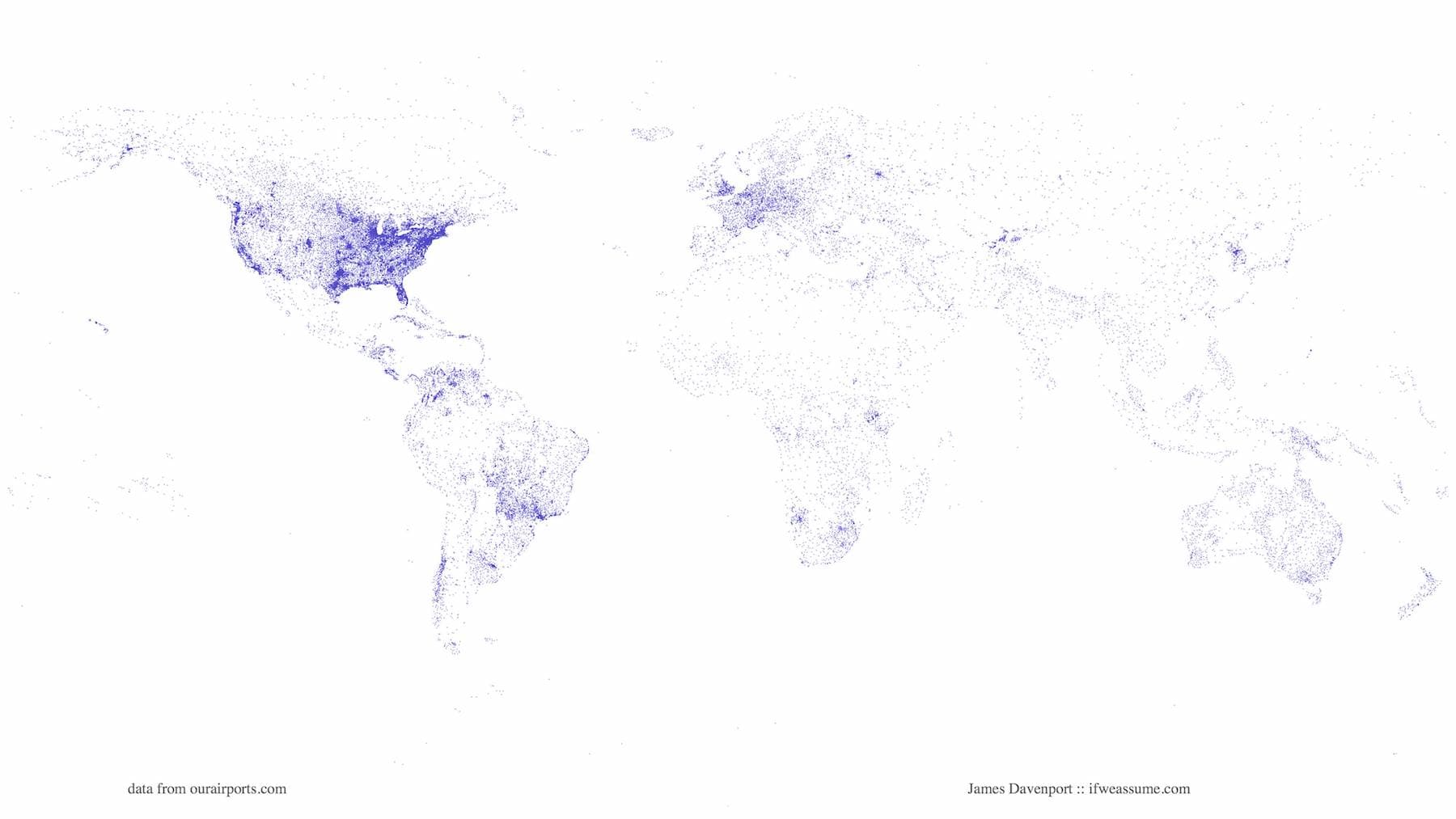
The world’s airports map
This map collectes the different airports around the world.
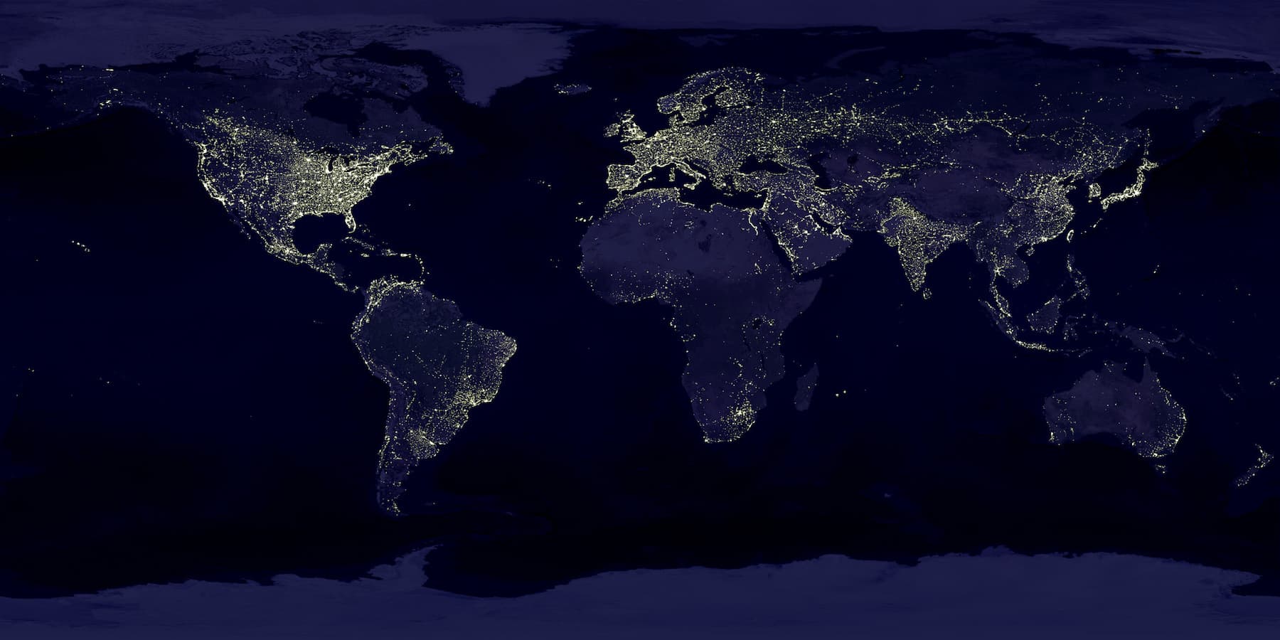
Night lights map
This map shows how lights from places around the world draw the world’s map at night.
Sources: Majestic (reddit), Microsiervos, Wikimedia, The world’s airports, DataCenterDynamics and NASA.